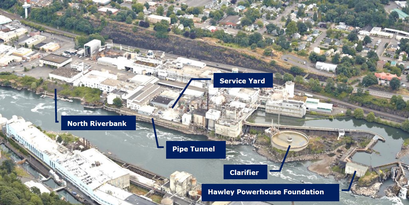
North Riverbank
Get ready - riverwalk design concepts are coming this November! Leading up to that, we are highlighting some key site elements that you will see in the design concepts, including the Pipe Tunnel, the North Riverbank, the Clarifier, the Service Yard, and the Hawley Powerhouse Foundation.
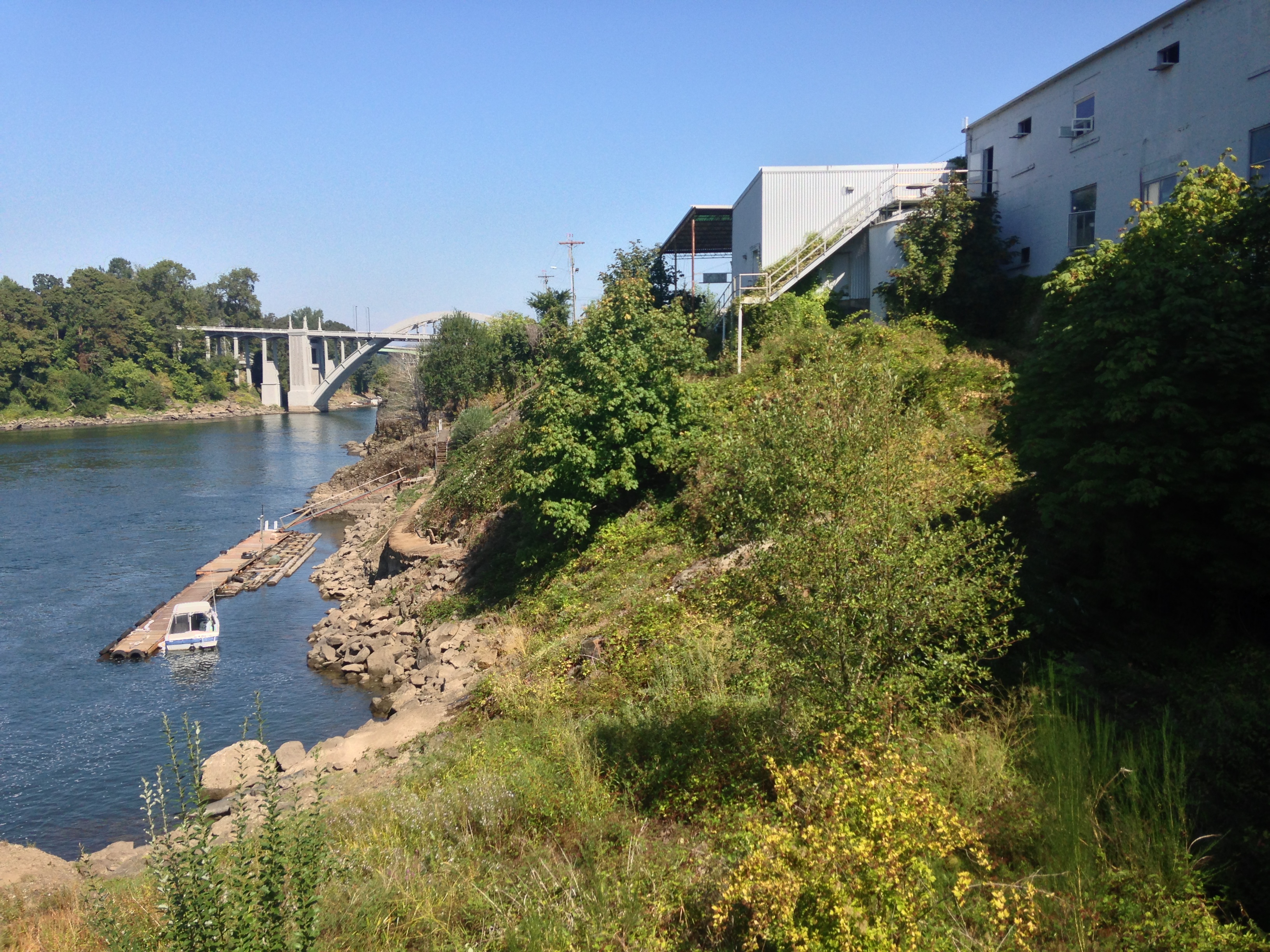
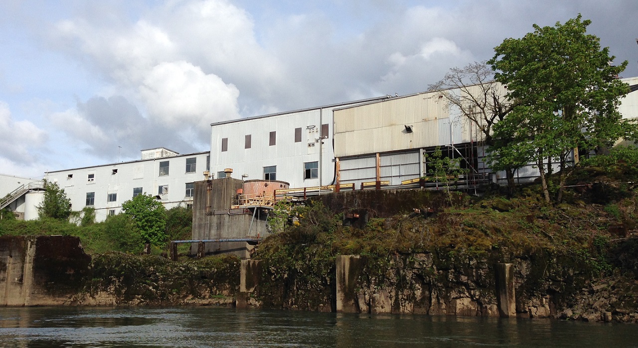
Rather than removing everything on site, our design team is investigating ways to reuse, enhance, or re-purpose structures and elements from the old mill and PGE dam. Today, we focus on the North Riverbank, 700 feet of Willamette river shoreline between historic 5th and 3rd streets. Mill buildings perched above the shore look down upon the vegetated area, with industrial structures such as tanks and oil bunkers jutting out from the overgrowth. A private dock floats down below, providing seasonal fishing access for the Oregon City Boat Club.
In the riverwalk opportunities report, our design team examined the north riverbank and found the following opportunities and constraints:
Opportunities
- Great potential for upland and riparian habitat restoration
- Dynamic, swift, active stretch of river in all seasons
- Industrial bulkhead provides some protection and a cove
- Interesting seasonal water level variation
- Some native basalt outcrops remaining
- Potential for dock improvements
- Located near terminus of east-west connection to Main St. (between historic 3rd and 5th streets).
- Valuable for cultural and natural interpretation
Constraints
- Water safety concerns; somewhat difficult place for water contact
- Swift current for boat maneuvering and docking
- Untreated municipal stormwater outfall
- Wide seasonal variation in water elevation (1996 flood level 50.69’)
- Steep riprap fill bank
In November, you will see different options for the north riverbank area in the riverwalk design concepts. We can't wait to hear what you think!